Embrace the Outdoors: Our Natural Heritage
Carpinteria is a welcoming community defined by the spectacular meeting of the mountains and the sea. The Explore Carpinteria initiative invites you to delve into the astonishing natural heritage that forms our backyard and sustains our spirit.
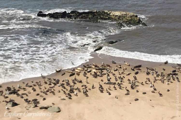
We are dedicated to mapping and celebrating the rich diversity of our environment, encompassing everything from the pristine beaches and expansive ocean to the critical habitats of the Carpinteria Salt Marsh and the bluffs protecting our seal rookery. Venture inland, and you’ll find the beautiful tapestry of our creeks, trees, foothills, and the majestic Santa Ynez Mountains.
Through this collaborative asset mapping, we are highlighting the networks of walking paths and trails that link these treasures, making it easier than ever to connect with nature. This effort not only promotes wellness but also strengthens the stewardship needed to protect these irreplaceable open spaces for every resident and visitor. Help us map and celebrate the wild heart of Carpinteria!
Landmark Trees
Wardholme Torrey Pine: Relics of the last Ice Age, Torrey pines naturally occur in just two locations: Santa Rosa Island in the Santa Barbara Channel and along the coast near La Jolla. Collected in 1888 as a seedling on Santa Rosa Island, this Torrey pine was planted by Judge Ward on the grounds of his home (Wardholme). It thrived in Carpinteria’s fertile soil, high water table, and perfect climate, soon growing beyond its normal height of 40-60 feet. It is considered to be the largest Torrey Pine in the world. At its centennial celebration, held in 1988, it measured an astounding 128 feet tall, 121 feet wide at the crown, and 20 feet in trunk circumference at a height of four feet above the ground.
Location: 5160 Carpinteria Avenue
Carpinteria Historical Landmark #1
Portola Sycamore: This ancient tree is reputed to be the site where Gaspar de Portola’s expedition stopped on August 17, 1769. Observing the Chumash building a plank canoe, the soldiers named the area “La Carpinteria” – the Carpenter Shop.
Location: East end of 6th Street
Carpinteria City Historic Landmark #5
Geological Curiosities
Tar Seep & Asphalt Mine Site: Gas pressure drives the tar, or asphaltum, to the surface through cracks and fissures in the rock from various deposits that underlie the entire area. The Chumash utilized tar as an adhesive, a sealant in their tomols (canoes) and water baskets, and as a significant item of trade. The area to the east, now Tar Pits Park, was once a large open-pit mine. Beginning in the 1880s, the asphalt was developed as one of the Valley’s first industries, selling for $36 per ton. It was used to pave local roads and was shipped nationwide. Following the mine’s closure in the 1930s, the large pits were gradually filled with city waste.
Location: On the beach at the end of Calle Ocho
Carpinteria Historic Landmark #6
Learn More →
UCSB land use and history article about the Carpinteria Salt Marsh