Click on the photo to see a full-sized image
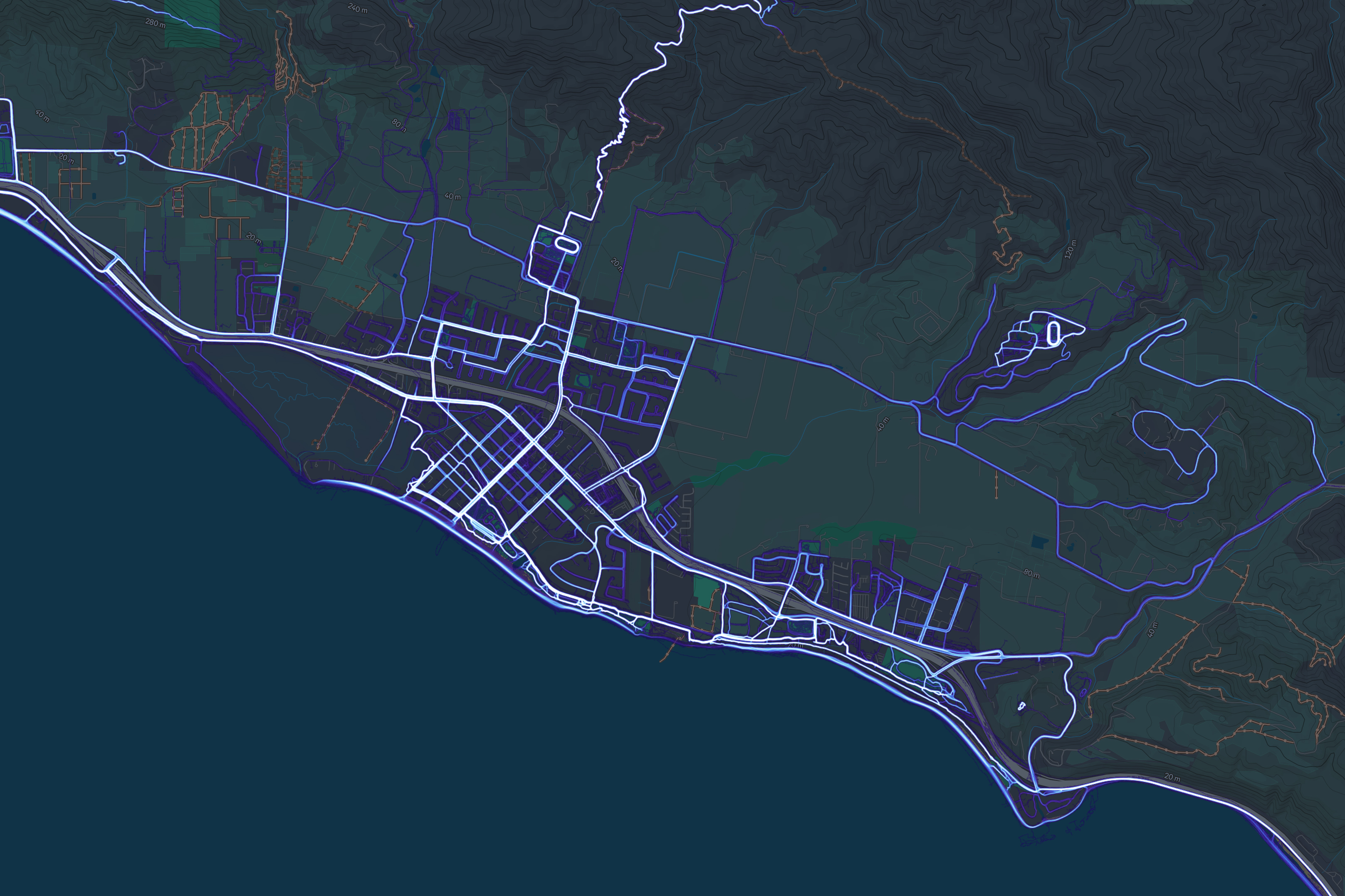
The image above of Carpinteria is a heat map that visually represents areas with high user activity (walking, hiking, and running) using color intensity (brighter = more popular), overlaid on a map. This type of map helps viewers discover popular routes, trails, and pedestrian areas in Carpinteria. The data is aggregated from publicly available user data and doesn’t show trail-specific details such as difficulty or legality.
The white lines are most popular, and the lighter blue is next most popular. With a paid account, users can view the data online and select specific activities, such as running or biking.
Preserving Our History And Culture
Trails can connect us to our heritage by preserving historic places and providing access to them. They can give people a sense of place and draw people to historical and cultural sites.
Learn more →
Map Source: Strava Global Heatmap
Article: Global Heatmap and Strava Metro